To Ulu Kale.

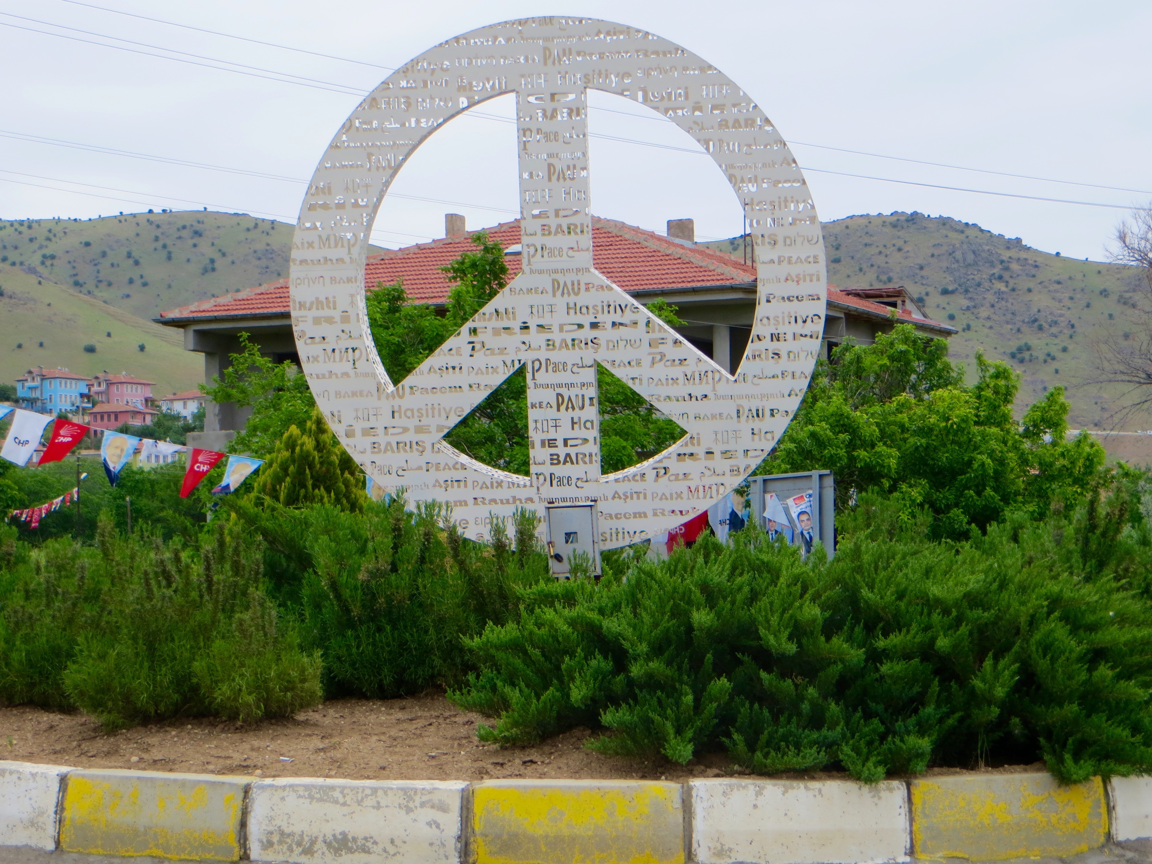
I had an excellent night’s sleep because of the comfortable bed and the quiet room, so was rested enough by 6.30am to walk to the ferry terminal to take more photos of the ferries and the castle. Because breakfast at the hotel was not served until 8.00am, I walked toward the roundabout with the peace sign, but, before getting that far, took a right turn along a dirt road that led toward the centre of Pertek past small apartment blocks, houses in large gardens and farms where families kept sheep and a few cattle. As the road ascended, the views of the reservoir and the castle steadily improved. Every so often, children waited to be picked up in a minibus and taken to school.

Before the reservoir had filled with water, two mosques were dismantled from the slopes on which old Pertek lay and reassembled in the modern town (in other words, the mosques lay on the slopes below the castle. The slopes were now below the level of the water, as were ruins including a church and a hamam). I caught glimpses of both the mosques. They had their origins in the 16th century. Baysungur Camii was a domed cube with a three-domed portico and a minaret. The portico’s walls and the minaret’s shaft were constructed with bands of chocolate-coloured and cream-coloured stone, but the walls of the prayer hall comprised of rubble stone. Celebi Ali Camii had some similarities with Baysungur Camii, but an iwan and a cesme helped to make it distinctive in appearance.

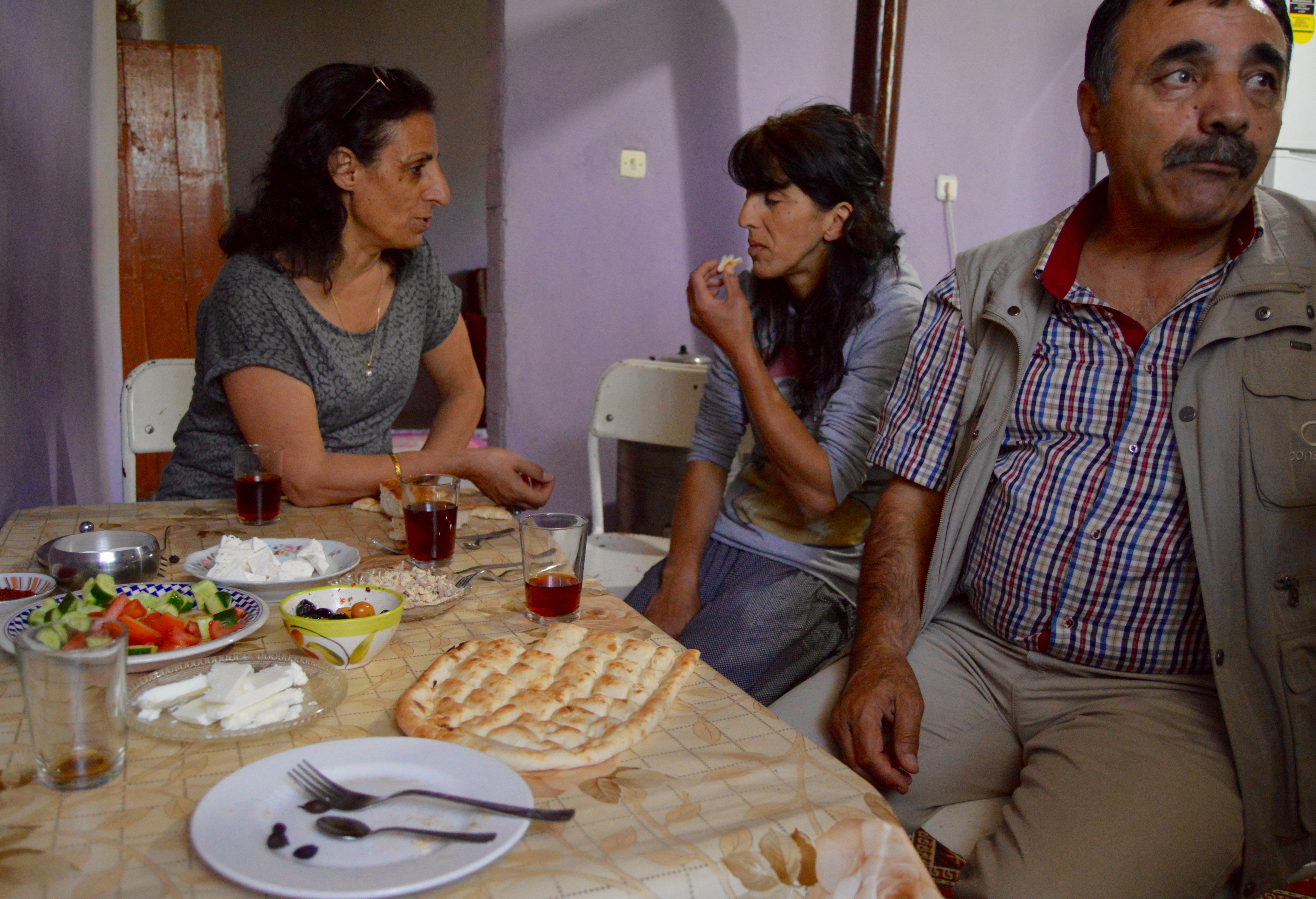
For breakfast, I was directed to the café and lokanta built in the large garden overlooking the reservoir the other side of the road from the hotel. I sat at a table facing the reservoir, the castle and the hills to the south-west and, about 15 minutes later, was given tea and a tray of food. For a hotel expensive by Turkish standards the food was not very imaginative, but, with a generous portion of bread to go with the tomatoes, cucumber, olives, three types of cheese, chips, boiled egg, honey in the comb, cherry jam, tea and water, I had no reason to complain. However, cloud was building up and turning the sun a little hazy. I expected the day to involve a lot of walking, so perhaps the cloud would prove a blessing in disguise.

My destinations for the day were Ulu Kale, about 10 to 15 kilometres from Cemisgezek, and Sagman, about 15 kilometres from Pertek. Both destinations lay off the main road to Cemisgezek, but the previous day’s travels had given me the opportunity to identify precisely where both roads to my destinations diverged. I had resolved to visit Ulu Kale first because it was further from Pertek.

Just before 9.00am, I left the hotel for the roundabout with the peace sign and, ten minutes after arriving there, a quietly spoken man driving an old Tofas offered me a lift to the junction for Dere. When I got out of the car, I was almost as far as the small supermarket where I had bought the ice cream the day before. I walked a short distance, then a car stopped with four men inside. The men were going to Cemisgezek to undertake a day’s work and they each had a small briefcase to confirm they were civil servants or professionals of some importance. Because the junction for Ulu Kale was only 3 or 4 kilometres from Akcapinar near where I had been the day before, I was taken most of the way to Cemisgezek. The journey confirmed that the road from Pertek to Cemisgezek was one of exceptional beauty and interest.

Between Pertek and Cemisgezek.

Between Pertek and Cemisgezek.

Because the car in which we travelled was very new and the driver wanted to show off his skills at the wheel, it was about 10.20am when I arrived at the junction for Ulu Kale. The sign at the bottom of the road suggested that the village was only 4 kilometres away, but by the time I arrived in its centre, it felt as if I had walked 5 or 5.5 kilometres. For most of the way, the ascent was merely steady and a lot of time was spent at or near the highest point along a ridge. I therefore secured excellent views of Payamduzu on the way to Akcapinar and Cemisgezek, and north toward snow-smudged mountains in the milli parki. The cloud cover remained quite thick, which imbued many a view with a grey tinge, but at least it was cool and the views extensive, not least over the reservoir. I encountered a few large flocks of sheep and goats. Once, I was worried that large dogs protecting a flock might make their way in my direction  because they had seen me and were barking in a threatening way. However, they decided to stay close to their shepherd instead.

Ulu Kale.

Ulu Kale.

Ulu Kale.

Ulu Kale.

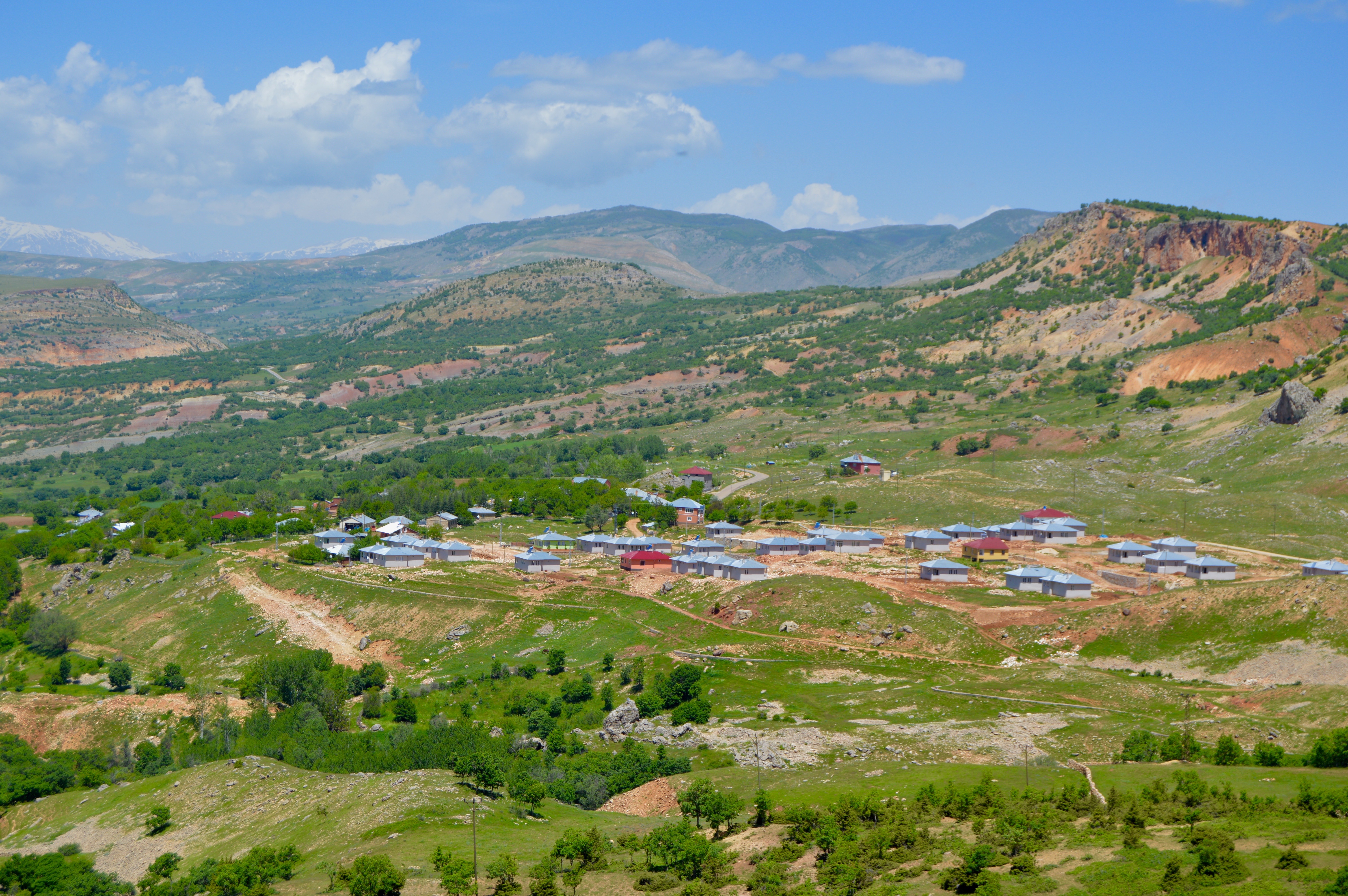
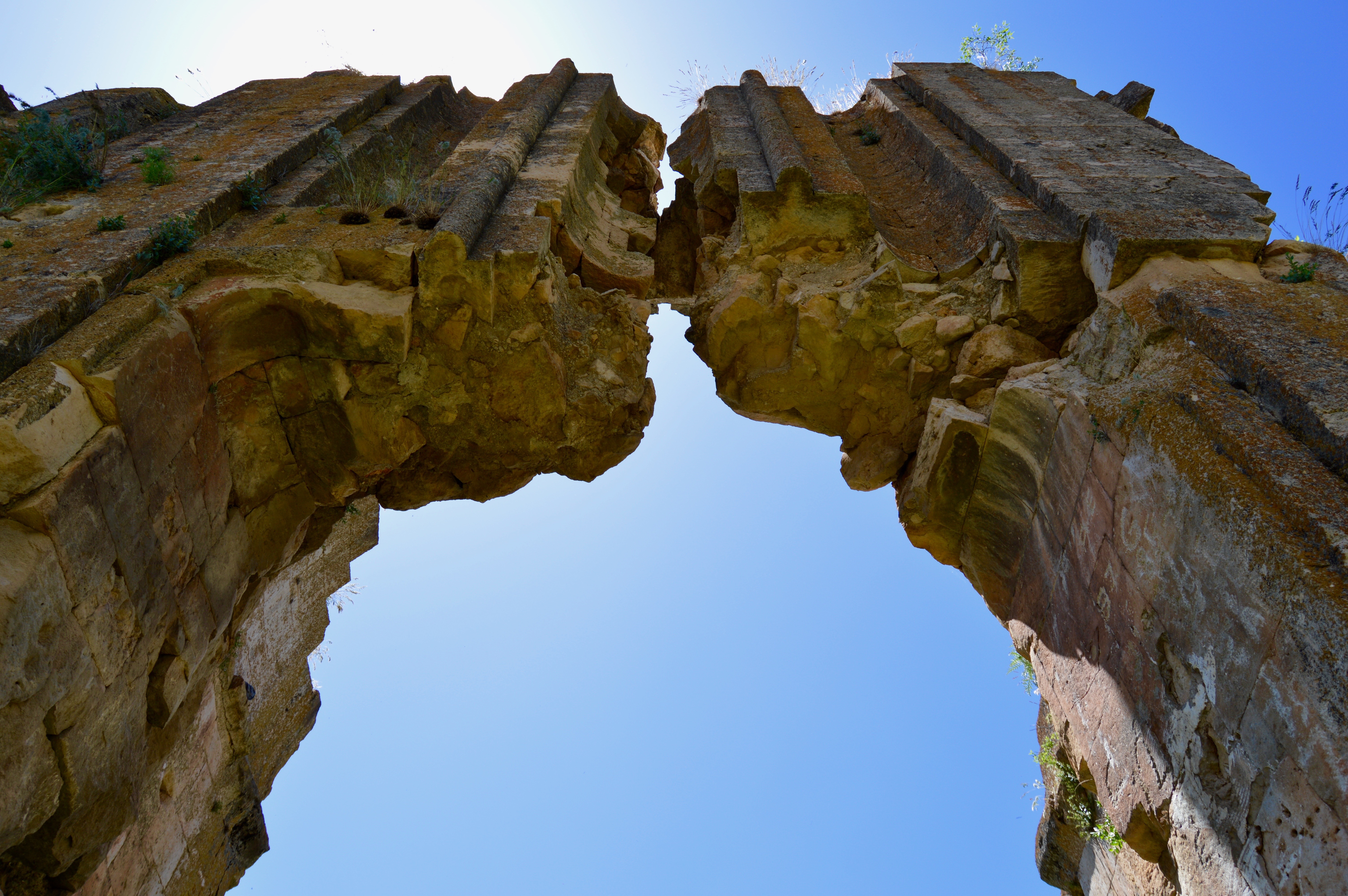
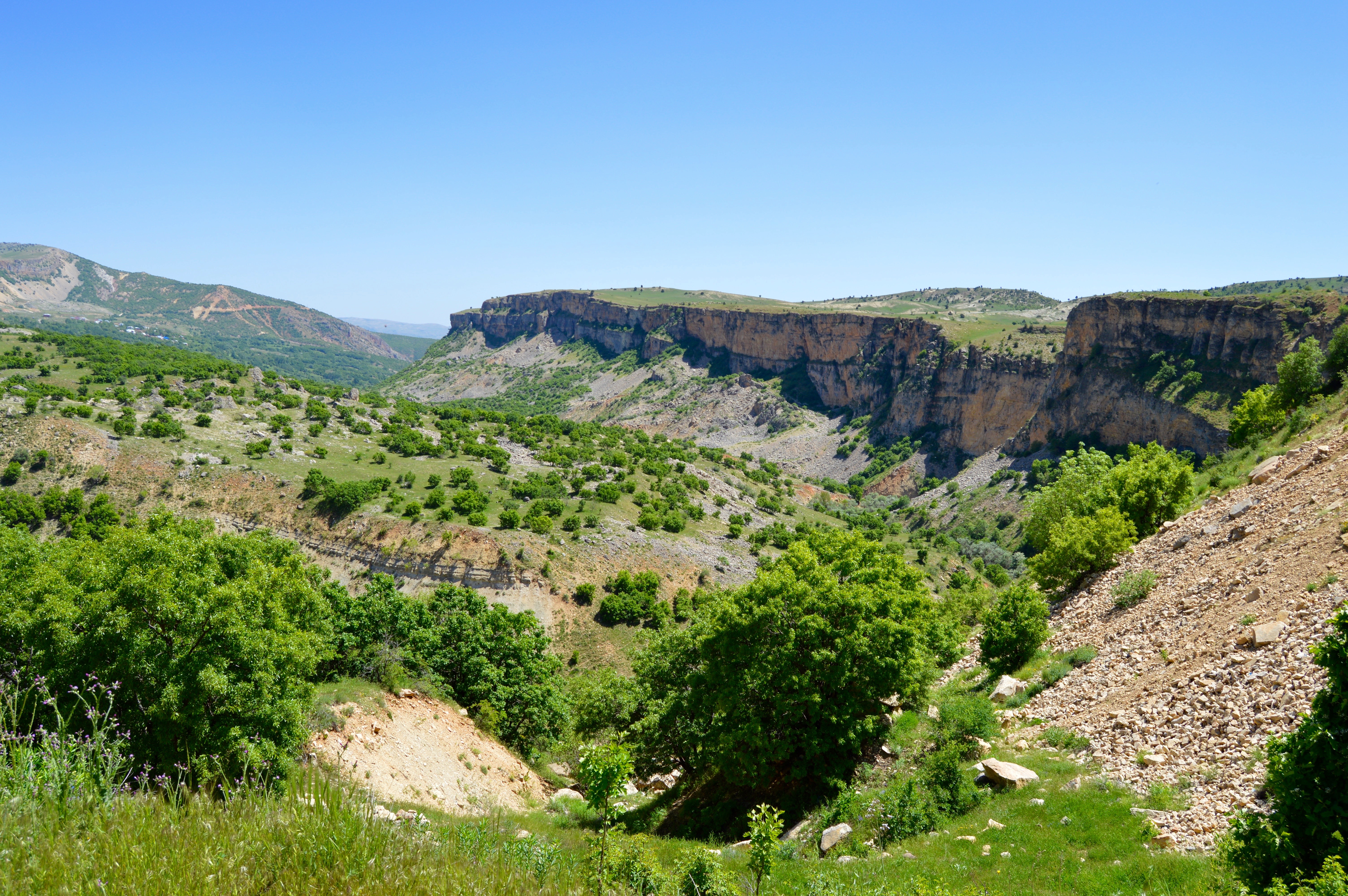
I rounded a corner and was at the westernmost edge of Ulu Kale. In recent decades, the village had shifted from its original position immediately below basalt cliffs crowned by the scant remains of a castle to a more accessible and gently sloping shelf looking south. However, the remains of the original village and the much larger new one lay in a bowl with cliffs and steep slopes rising to the west, the north and the east. Once the houses and other facilities of the village somewhat abruptly concluded, fields, orchards and pasture led toward a river to the south. At the entrance to the village on the west side was a most unusual sight in a Turkish village, identical modern houses arranged in regular fashion along new roads that strictly belonged in a new suburb in one of the large conurbations far to the west. The pitched roofs, brightly painted render walls, satellite dishes and small gardens behind wire fences would have looked perfectly at home in parts of Bursa or Eskisehir. Or, with minor tweaking, in Birmingham in the UK.

View south from Ulu Kale.

View south from Ulu Kale.

Ulu Kale.

Ulu Kale.

Despite Ulu Kale being enclosed by cliffs and slopes immediately to the north, open views existed south-east and south-west, and the hills to the south were far enough away to create a welcome sense of spaciousness. Although the most interesting houses were the ones in the original village (they had been built with stone and were large), only a few remained and they looked as if they had been abandoned. The houses in the new village were of interest because a mixture of stone, mudbrick, concrete, render, wood, corrugated iron and flat sheets of metal have been used to good visual effect. Most houses had a patch of garden surrounding them where trees, flowers and a few vegetables could be grown.

Part of the old village, Ulu Kale.

Part of the old village, Ulu Kale.

Part of the old village below the castle, Ulu Kale.

Part of the old village below the castle, Ulu Kale.

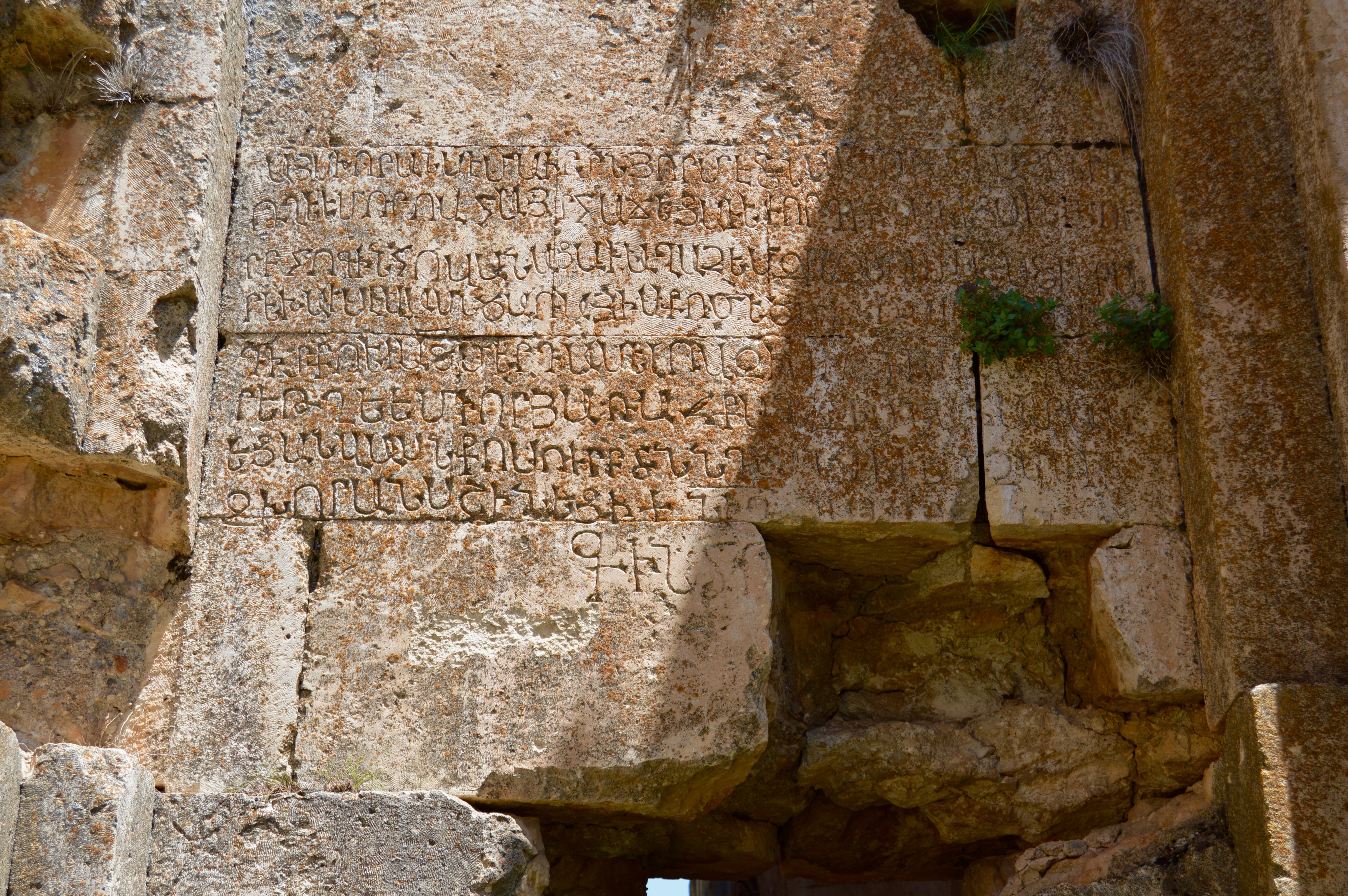
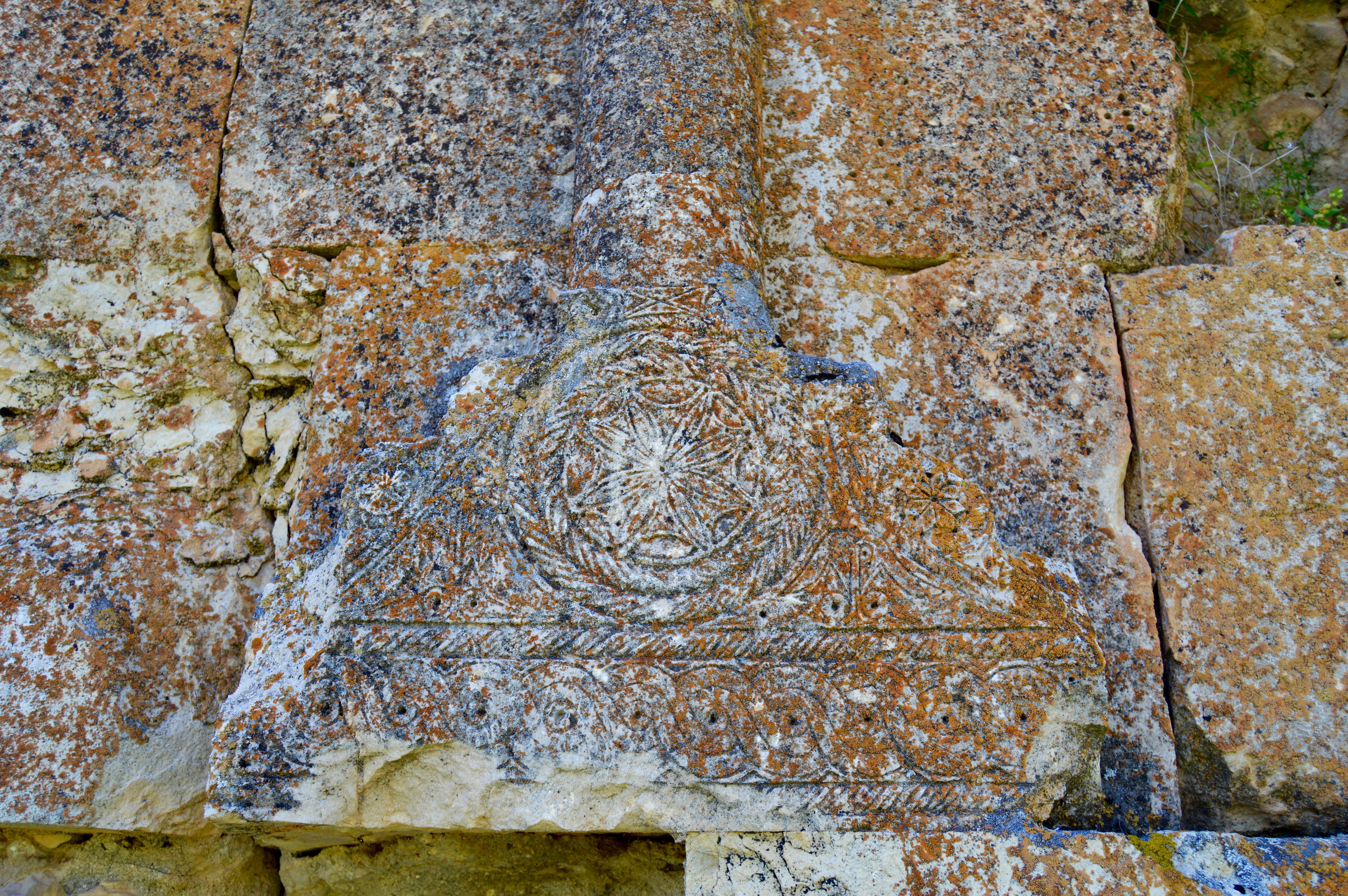
Between the original village and the new one was a turbe with an octagonal ground plan. According to Sinclair, it was built in 1550 for someone called Ferruhsad Bey:

Three courses of a rich red stone run round the trunk. Two large windows in arched recesses to e. and w. Beside the mihrab, which is partly lost, there are niches in the se. and sw. walls of the interior. The brick interior dome is revealed by the loss of the exterior pyramidal cap. There is a small crypt.

The turbe, Ulu Kale.

The turbe, Ulu Kale.

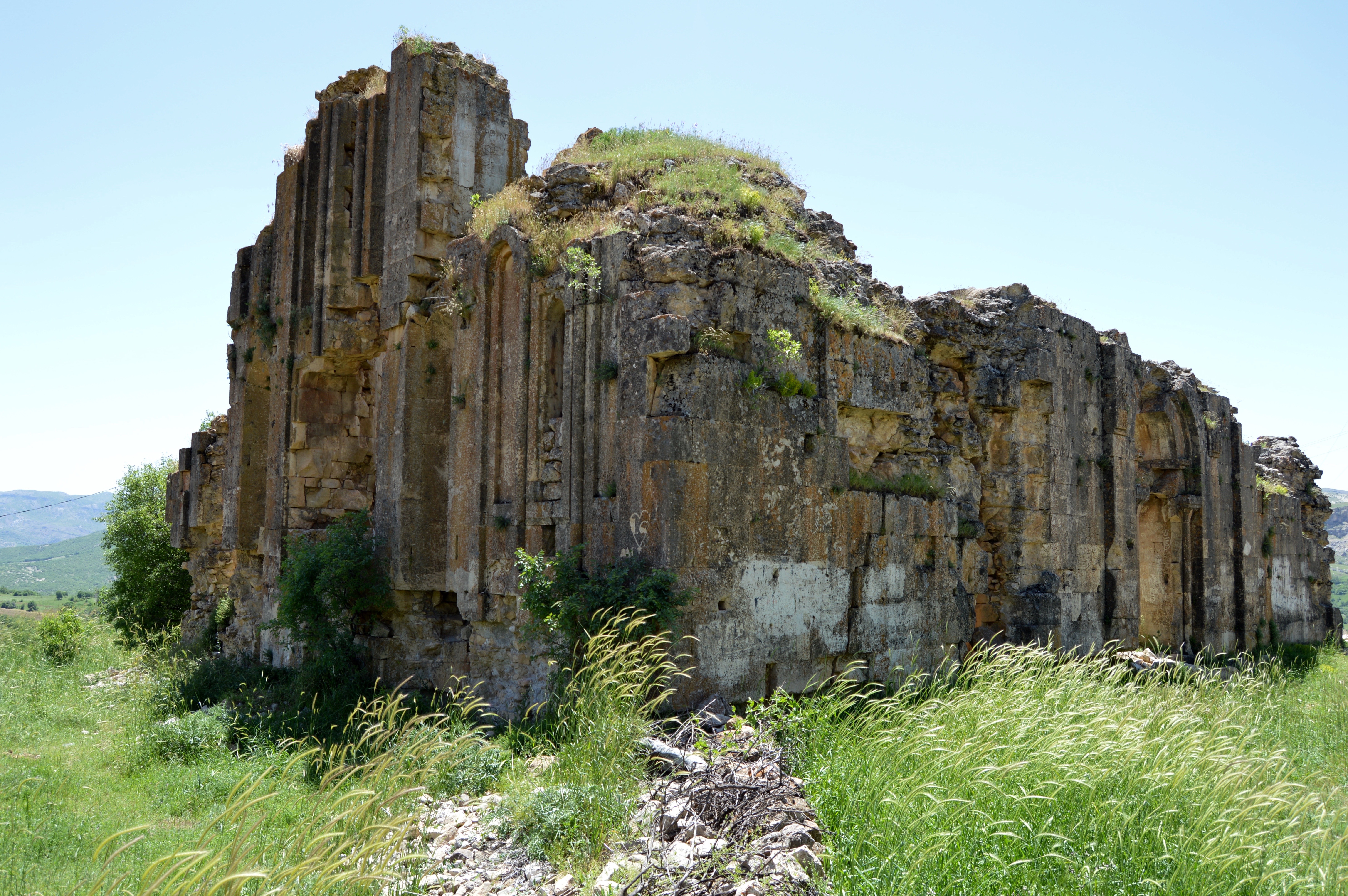
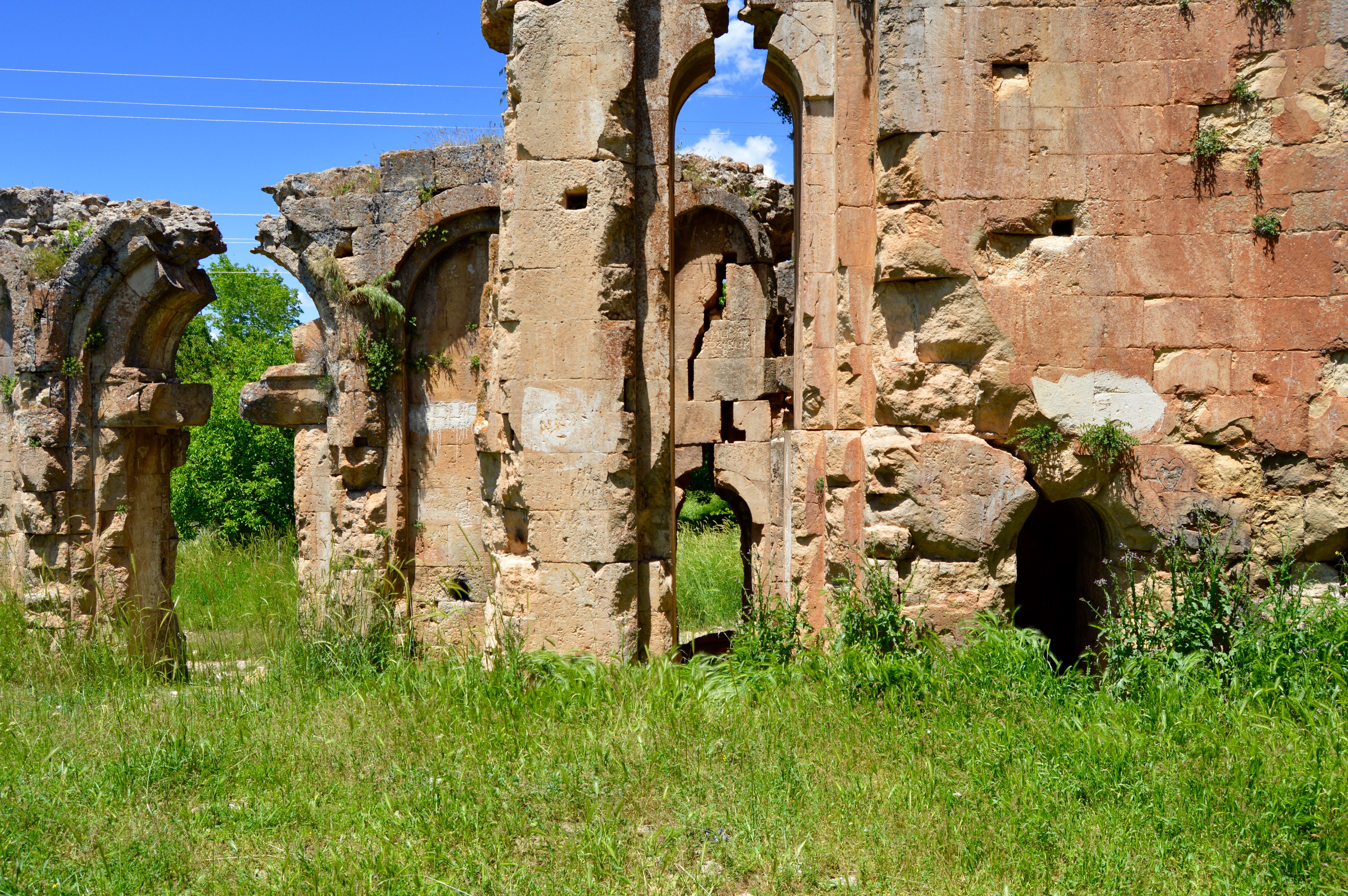
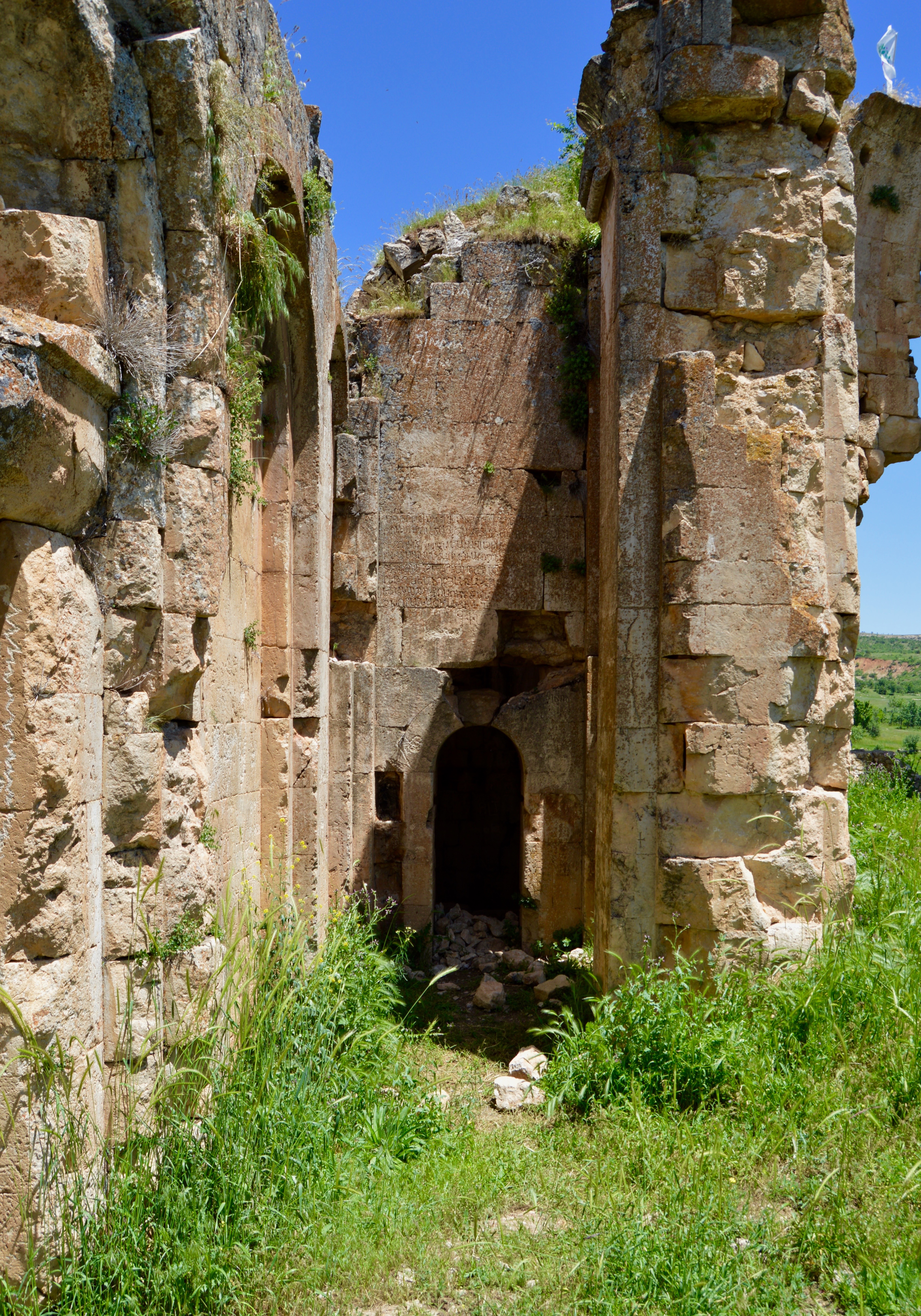
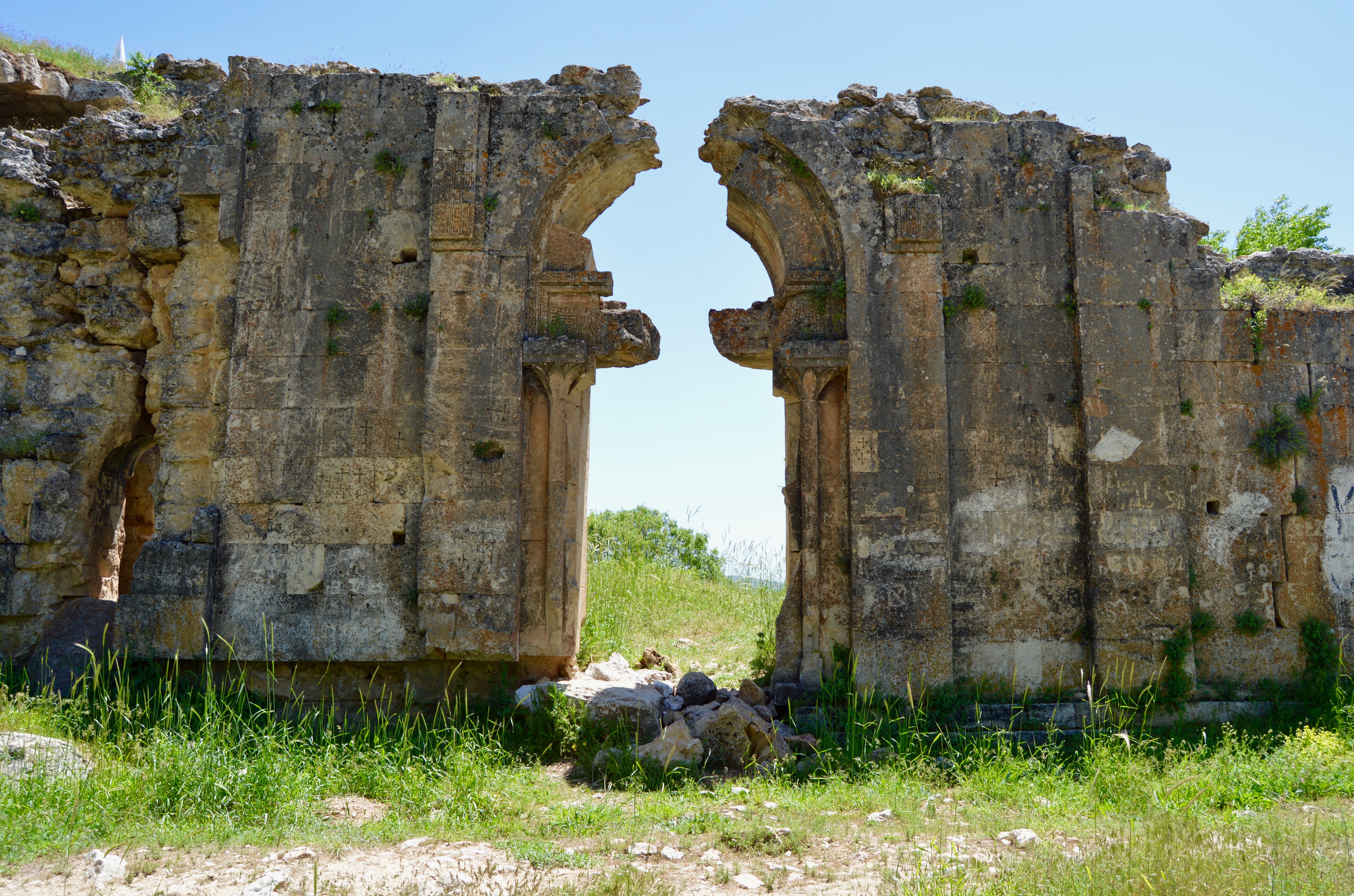
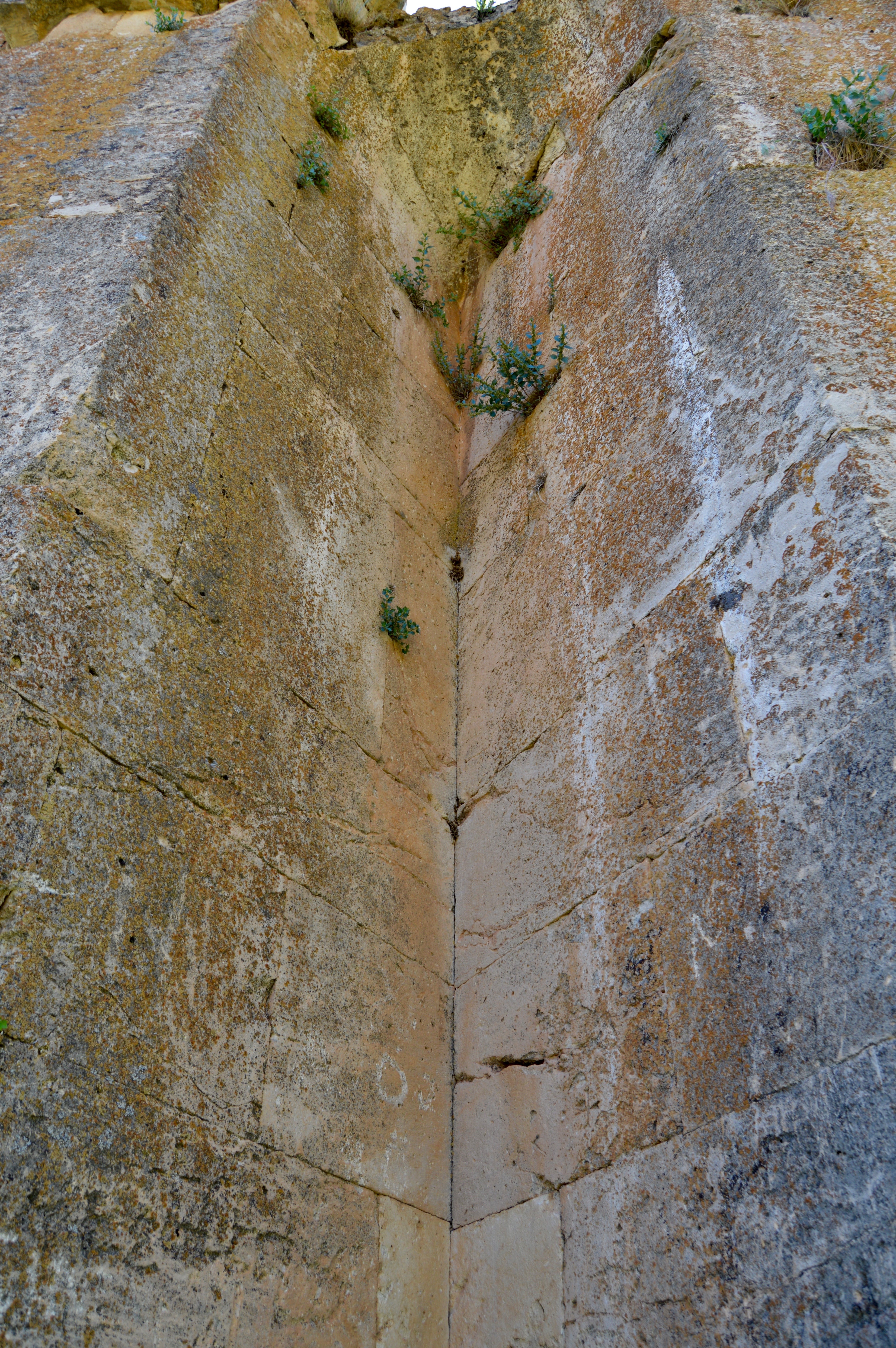
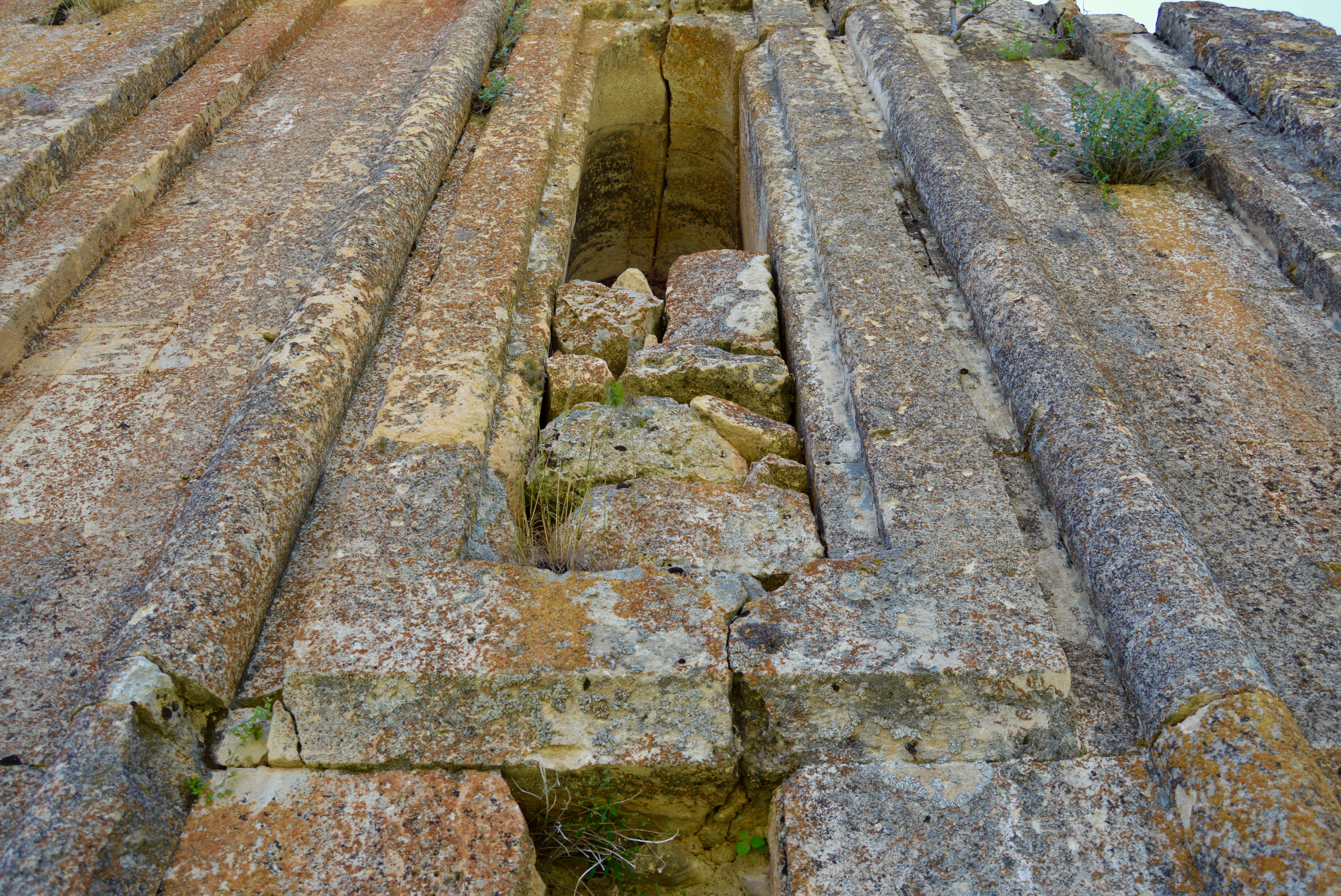
Not far from the turbe was a ruin described to me as a church. I could find nothing to confirm what the ruin had been, but Sinclair describes a church more or less where the ruin was. He writes that it was:

Single nave, one rib. Semi-circular apse, ruined. Entrance wall mostly fallen. Large blocks used. Probably 17th or 18th century.

The ruined church (?), Ulu Kale.

The ruined church (?), Ulu Kale.

The ruined church (?), Ulu Kale.

The ruined church (?), Ulu Kale.

Photos of Ulu Kale on the internet taken a few years ago confirm that many old houses, even then in a very neglected state, had disappeared altogether, and it was obvious from Sinclair’s monumental study of eastern Turkey that very little of the castle survived. However, I was glad I had made the effort to visit the village, not least for its dramatic natural surroundings. I noticed that a road meandered along the river in an easterly direction leading after a few kilometres to Bozagac and, if nothing else, the scenery must be very rewarding. From Bozagac, a road led to the one between Pertek and Cemisgezek. Could this be a round walk for a future visit? Perhaps.

View east from Ulu Kale.

View east from Ulu Kale.

Local wildlife, Ulu Kale.

Local wildlife, Ulu Kale.

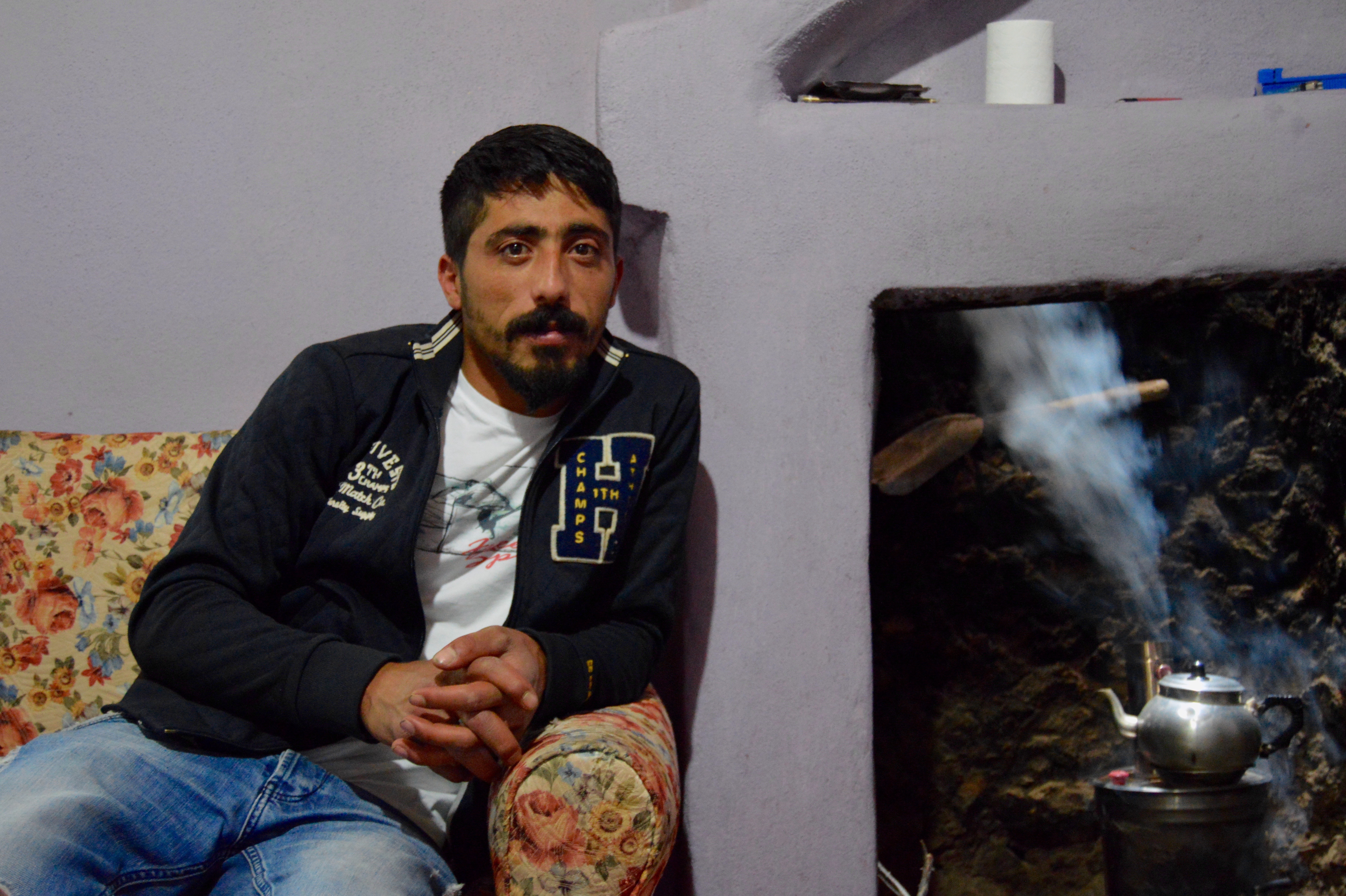
So little traffic went from Ulu Kale to the Pertek to Cemisgezek road during the day that I had to walk all the way to the junction, but at least I was going downhill most of the time and could enjoy extensive views of the reservoir. Once at the junction, I had to wait only a short time for a lift all the way to the junction for Sagman. I was travelling with a man of local importance (he toured the region to confirm that road works were completed to a satisfactory standard) because he was in a new and very comfortable car with a chauffeur. The chauffeur said that he played professional football for a club in a league two levels below the top-flight clubs and that his job as a chauffeur terminated once the football season began. Both men were Alevis. They combined friendliness with a reflective frame of mind, but warned me that most people in Sagman were Sunni Muslims.

Between Ulu Kale and the Pertek to Cemisgezek road.

Between Ulu Kale and the Pertek to Cemisgezek road.

To Cemisgezek and the Termal Hotel.

Because of being dropped off where hills, a river, trees, pasture, wild flowers and lots of beehives presented an image of rural bliss, I decided to wait until a lift arrived and, after only 20 minutes, a small open-topped lorry drew to a halt. The driver already had two men in the cab and on the back of the lorry were two cows. I was lucky. The men and their cows were going to Cemisgezek. The two passengers shuffled along to make room for me and, just over an hour later, we arrived at our destination. While the driver said almost nothing the whole journey other than to reassure me that my presence was not a problem, the two passengers chattered incessantly in Zazaki, a language that I understood even less well than Kurmanji. I got the feeling they were gossiping about people they knew and about whether such people could be trusted when transacting business, because every so often sums of money were mentioned.

Between Hozat and Cemisgezek.

Between Hozat and Cemisgezek.

The journeys to and from Hozat and to and from the Armenian church had been remarkable, not least because the roads along which I travelled were usually high up so the views were extensive, but even more enjoyable was the journey to and from the junction where the lorry picked me up. When meandering along the valley floor, not once were we confined by a narrow gorge. The trees and small fields beside the rivers provided intimate counterpoint to the grandeur of the upland surroundings. However, a lot of time was spent high among rounded hills. The views were uninterrupted and took in distant mountains and the Keban Reservoir. There was pasture along the road and in the middle distance, and it sometimes covered the summits of the hills and mountains, but it was not quite as good as further north and east. Consequently, sheep and goats were more numerous than cattle and some of the flocks were enormous.

After about 40 kilometres of stunning upland scenery, we arrived in the centre of Cemisgezek, which lay above a river in a deep gorge with cliffs and mountains around it. By now it was 3.00pm and, when I explained that I had to return to Pertek that evening, the driver and his two companions expressed some alarm because minibuses did not travel the whole distance, only to the ferry a few kilometres to the south-east to take a short cut to Elazig. I felt confident I could hitch to my destination, but, to increase the chances of getting to Pertek before nightfall, I looked around the town for just over an hour.

Cemisgezek.

Suleymaniye Camii, Cemisgezek.

Cemisgezek.

Cemisgezek.

Cemisgezek.

Cemisgezek.

Cemisgezek was large enough to have a vibrant commercial heart and a small pazar, the latter largely confined to a narrow street devoid of motorised traffic. Although modern structures of limited architectural merit outnumbered the old buildings, most of which were houses, enough of the latter survived to make the town a detour well worth undertaking (day trips from Elazig could be considered, given that minibuses ran most of the day. Cemisgezek did not seem to have a hotel worth staying in). Although some tooth-like rocks and a few traces of masonry revealed where the castle used to be high above the river in its gorge, other monuments from the past were of greater interest. Yelmaniye Camii dated from 1400. It had a portal with interesting carved ornamentation and a bright and attractive interior with a mihrab with a deep niche. Suleymaniye Camii had an impressive minaret dating from the Selcuk period. The town centre had two hamams. A turbe and a bridge, then latter with a single pointed arch, were in the nearby countryside.

The pazar, Cemisgezek.

The pazar, Cemisgezek.

Yelmaniye Camii, Cemisgezek.

Yelmaniye Camii, Cemisgezek.

Cemisgezek.

Cemisgezek.

Overlooking the town from the west were some caves in a cliff. One of the caves had some Armenian graffiti which Sinclair dates to the late 19th century. Sinclair also says that the caves were lived in until 1938 by Alevi Kurds who took part in “the Dersim revolt”. After a general pardon for prisoners, the Alevi Kurds who remained alive were given yaylas behind Yilan Dani “further up the valley of the Cemisgezek Su” and “enough money to buy flocks, even to build houses”.

Cemisgezek.

Cemisgezek.

While all the monuments just listed made a detour to Cemisgezek worthwhile, the old houses were the town’s most remarkable feature (however, the town seemed to be dominated by Alevis and everyone was very friendly, so this was another reason to visit a settlement a little off the beaten track). Many of the old houses survived as two-storey terraces along cobbled streets. The houses were timber-framed and the mudbrick walls were covered with render. People liked to paint the walls a rich variety of colours, some of which had attractive shades reminiscent of pastel crayons and ice cream. The narrower streets were overhung by the balconies of the upper storeys and the ground floors were sometimes a little below the level of the road.

Cemisgezek.

Cemisgezek.

Cemisgezek.

Cemisgezek.

Cemisgezek.

Cemisgezek.

I asked someone where the cemevi was located and was directed through the commercial heart of the town to a road leading to the north. The road ascended into an area that quickly became overwhelmingly residential. A few old stone houses survived, some of which spread over only one storey. I asked a woman for further directions and was urged to look down into a depression more or less constituting the northern extremity of Cemisgezek. I looked over a wall and saw a modern cemevi among some of the town’s newest houses. I was told it was called Kirklar Cemevi, or 40 Cemevi. For Alevis and Bektashis, the number 40 had special meaning. For some Alevis and Bektashis it referred to the 40 “saints” Muhammad is said to have encountered during his nocturnal ascent to heaven/paradise, and for others it referred to the 40 levels that applied to the four gates, or life stages, that made up the Alevi and Bektashi spiritual path (the path was usually identified by the Turkish word “yol”, a word commonly translated to mean “road”).

The cemevi, Cemisgezek.

The cemevi, Cemisgezek.

Cemisgezek.

Cemisgezek.

Cemisgezek.

Cemisgezek.

Because Cemisgezek had so much to enjoy, I stayed considerably longer than an hour. Just as I set off to walk out of the town to find somewhere from where to hitch a lift, I was stopped by three young women, all second year university students. We chatted a while and, although two of the women wore headscarves, photos had to be taken before I could resume my walk. Here were yet more friendly people, in this case female, and two were conventionally pious Sunni women willing to risk criticism for chatting with an unknown male. But Sunni women could get away with such unconventional behaviour in Dersim because gender equality and the empowerment of women were the norm. Such behaviour would be much less likely to manifest itself in Elazig or Erzincan.

Cemisgezek.

Cemisgezek.

Cemisgezek.

Cemisgezek.

Cemisgezek.

Cemisgezek.

I had walked about a half kilometre out of the town when a tractor stopped and the driver let me climb aboard for a lift of about 3 kilometres, which not only took me far beyond the last buildings of Cemisgezek, but also well into the delightful countryside to the south. I stood beside the road and five minutes later a man drove me to the northern edge of Akcapinar, the first village from Cemisgezek. By now, the sun was beginning its descent to the horizon. As a result, visibility was improving all the time. At the point I was dropped off, I looked down toward Akcapinar across gently undulating fields and pasture, and beyond the fields and pasture was the Keban Reservoir with water a deeper blue than at any point during the day. Hills and mountains dominated the distance.

View south from Cemisgezek.

View south from Cemisgezek.

About ten minutes later, a lorry drew to a halt and who should be in the cab but exactly the same three men who had driven me to Cemisgezek earlier in the day! I was surprised to see both cows were still on the back of the lorry, but it turned out that the men had been to Cemisgezek to undertake business that did not involve the livestock. Both cows were destined for one of the men’s small farms near Hozat.

Because the sun was behind us and the visibility very good, the journey to the junction for Hozat was even more enchanting than it had been when we drove to Cemisgezek. I identified about a dozen places where I wanted to stop, sometimes to take photos of the scenery alone and sometimes to take photos of shepherds and their large flocks of sheep and goats in their natural surroundings. A  few unusual farm buildings were beside or not far from the road. When we finally arrived at the junction for Hozat, I wanted to give the driver some money for helping me fulfil most of the second part of the day’s programme, but he would not accept the notes in my hand. We were now friends even though we would probably never see each other again.

I walked a short way along the road toward Pertek, then saw to my right a small but ill-stocked supermarket occupying the ground floor of what was a large house or small apartment block. The building stood alone, but I could tell that the supermarket sold ice cream and beer. I called in for an ice cream and a chat with an elderly Alevi man who was the owner of the supermarket. The man was a retired guestworker who had made his money in Germany. He said that he owned the whole building and not just the supermarket.

I walked a little further along the road, then a lorry stopped and the driver and his companion offered me a lift all the way to the ferry that departed from near the Termal Hotel. Once again the scenery through which we passed looked delightful, especially as it was now about 6.00pm and the shadows were lengthening.

The two men in the cab were Kurdish Bektashis. It did not take long before discussion about the forthcoming election shifted to criticism of the Sunni majority in Turkey that had always oppressed Alevis and Bektashis. One of the men grew unusually animated as he described past injustices. His anger subsided only when we passed the turning for Dorutay where I was told that some turbes were pilgrimage sites for Alevis and Bektashis.

The Kurdish Bektashis who gave me a lift to the ferry terminal, Pertek.

The Kurdish Bektashis who gave me a lift to the ferry terminal, Pertek.

I stayed with the men until we arrived at the terminal because I wanted to take some photos of the castle and the ferry in the excellent early evening light, then I went to the hotel, showered and changed my clothes. I walked toward the roundabout with the large peace sign in the middle knowing that I would arrive at a small roadside bufe selling beer and snacks before I got there. I bought a beer and a packet of crisps. Along with a boiled egg saved from a breakfast in Tunceli two days earlier and a packet of salt left over from a THY meal at the start of the trip, this was all I could consume, given the excellent lunch and ice cream earlier in the day. On the way back from the bufe, the setting sun filled the sky with vibrant colours. I lined up some trees so they stood in silhouette in front of the reservoir and the multi-coloured sky before taking two photos. A little later, I walked beside the large jandarma post near the hotel so I could take photos of the castle from beside a small jetty. One of the men on guard duty in a tower overlooking the reservoir reminded me not to point the camera toward the jandarma post.

Pertek Kale and the ferry.

Pertek Kale and the ferry.

Sunset, Keban Reservoir, Pertek.

Sunset, Keban Reservoir, Pertek.

Sunset, Keban Reservoir, Pertek.

Sunset, Keban Reservoir, Pertek.

The ferry, Pertek.

The ferry, Pertek.

I examined the photographic results of a brilliant day’s adventures as I consumed my evening meal in my very comfortable bedroom. One thing I noticed was that there were not as many wild flowers as in the parts of Dersim visited the two previous days, but there were enough to make it worthwhile to arrange beehives on the hillsides and along the valley floors. At one point I had seen what proved to be the trip’s largest single collection of beehives in one place, a number far exceeding 100, and the beehives belonged to only three men.

Termal Hotel, Pertek.

Termal Hotel, Pertek.

To Hozat and Ergen Armenian Church.

Due to the early start in Tunceli, I was in my room by 9.45am. However, I was out again by 10.15am with my bottle full of water taken from a tap in the spacious bathroom (I filled the bottle on many occasions during the day and was impressed that many places had the facilities for me to do so). What were my destinations for the day, provided everything went to plan? Hozat, from where I wanted to visit the ruined Armenian church in or near the village of Gecimli (in some sources, the church was misleadingly said to be in In, but In was about 3 kilometres from the church. Ergen was another name used to identify where the church was. Ergen was probably the old name for Gecimli), and Cemisgezek, a town with a a few important monuments of considerable age. Cemisgezek was also rumoured to have interesting old houses, but how many had survived to the present day I could not establish from afar.

Because getting to the ruined Armenian church from Hozat would probably involve a time-consuming walk along a road devoid of traffic, I hoped to access Hozat first, but I would allow the destination of the first lift to determine the day’s precise programme. I walked north from the hotel for about 1.5 kilometres to a roundabout where a right turn went to modern Pertek and a left turn went to Hozat and Cemisgezek. At the centre of the roundabout was the widely known sign of peace inside a circle first popularised by the anti-nuclear weapons’ movement, and on the sign was the word “peace” in many languages.

The roundabout, Pertek.

The roundabout, Pertek.

I had been at the roundabout for only five minutes when a minibus came down the gently inclined hill from modern Pertek. I flagged down the minibus and was told it was going to Hozat. Perfection.

At first, the road clung to the shore of the reservoir, but, once we had passed the turning for Sagman, a village I would visit the next day, it almost immediately began to ascend into the rounded hills from where there were extensive views over the reservoir and toward distant mountains. Almost every moment of the rest of the day was spent in glorious upland scenery, sometimes surrounded by mountains and sometimes with the vast reservoir in view. From the scenic point of view, this was to prove perhaps the most rewarding day of the trip. It is true that the scenery in Munzur Vadisi Milli Parki was more spectacular and enchanting, but what I encountered today was more extensive. Moreover, there were times when the scenery assumed an austere, even forbidding, character because trees were sometimes absent from view and rainfall in the region less frequent than further north and east. Suffice it to say that I was in remarkably beautiful upland scenery different in character from that in the milli parki. There were fields, orchards, pasture, wild flowers, large herds of cattle, very large flocks of sheep and goats, many small settlements worthy of examination (some small settlements lay along the roads, but most were some distance from and above them) and lots of very friendly and helpful people. Moreover, later in the day, as the sun began its descent toward the horizon in the west, the visibility assumed a clarity of exceptional quality. What more could anyone ask for?

The road to Hozat split from the one to Cemisgezek at a hamlet between Dorutay and Akdemir, and very soon entered a valley narrower than many in the area. The ascent to Hozat was gradual but consistent, and the mountains of the milli parki lay to the north. The closer we got to our destination, the more the scenery recalled that of the milli parki and the Ovacik area.

We arrived in Hozat, a small town on a gently inclined shelf above the valley along which the road had ascended. With mountains around it no one could fault its attractive surroundings, but Hozat was overwhelmingly modern and almost indistinguishable from a thousand Turkish towns of similar size.

Hozat.

Hozat.

By now I had been befriended by an Alevi couple with a remarkably liberal disposition who had travelled on the minibus since it left Pertek. The couple not only explained that Hozat was overwhelmingly Alevi, but helped me get to the ruined Armenian church. They had to visit some people in a village near the church. We retired to a tea house for glasses of tea and a cup of coffee each, and a three phone calls were made. A few people came for a short chat, then, about half an hour later, we climbed into a minibus driven by a man aged about 25. The Alevi couple stopped the minibus not long after it had set off to buy fruit, vegetables, cheese and bread, supplies for the people they wanted to see in what must have been a village devoid of shops.

Hozat.

Hozat.

We drove about 2 kilometres along the road toward Pertek, then took a left turn. The road crossed the river and meandered along the east wall of the valley. Most unusually, a sign beside the road junction indicated that Ergen Kilisesi lay 9 kilometres away. In 99 out of every 100 cases, minor Armenian ruins in Turkey were not signed for walkers or passing motorists. The only explanation I could give for this exception to the rule was that I was in Dersim where all minority communities had been brought together in a spirit of comradeship by decades of secular and Sunni Turkish oppression.

To Ergen Armenian Church.

To Ergen Armenian Church.

The road occasionally ascended to a considerable height and the views were outstanding. After driving about 7 kilometres, we took a left and ascended into a very small settlement on an exposed hillside. The minibus drew to a halt outside an old stone house with a flat roof with rooms arranged on only one storey. We had arrived at the house of the friends the Alevi couple wanted to see. Their male friend, a tall and hyperactive individual aged about 40, lived with his partner aged about 32. The couple were unmarried, which was most unusual in Turkey, even in urban centres such as Istanbul, Ankara, Izmir and Bursa which thought of themselves as being very liberal and progressive.

Between Hozat and Ergen Armenian Church.

Between Hozat and Ergen Armenian Church.

Although the couple in the house had recently installed some kitchen units and a new fridge and cooker, they lived a very simple life in the hills. But for a TV and a few electrical gadgets, they had little more than a family might have had that depended on agriculture to make a living (although there was an impressive collection of bottles with alcoholic drinks on a cupboard in the hall). Their main source of income seemed to be sheep and goats, many of which were temporarily confined to a rectangular enclosure of dry stone walls covered with a large blue sheet made of artificial material no doubt designed to protect the flock from the sun. But what confirmed I was in the company of a couple living an unconventional lifestyle by Turkish standards was a poster of Ibrahim Kaypakkaya hanging on the dark-coloured plaster wall of one of their rooms. I was in the company of communist sympathisers who had chosen to live their lives far from the madding crowd. This meant that they were far from the prying eyes of the police and other uniformed representatives of the Turkish state. Little things during the hour or so that followed suggested to me that both had strong sympathies for the PKK and that the male half of the couple may have fought on its behalf (the woman may have done so as well, for all I know). After she had prepared a wonderful lunch of mild white cheese, olives in a herb and oil dressing, tomatoes, cucumber, helva, bread, butter and tea (the tomatoes, cucumber and bread had just arrived from Hozat, but the cheese and butter were locally sourced. Both the latter were outstanding), the young woman pecked at her food, rolled her own cigarettes with tobacco grown in the Adiyaman area and discussed things as an equal with everyone else. However, not once did she smile. For the whole time she looked as if the problems of a blatantly unjust world, a world in which the oppression of the people least equipped to care for themselves was almost universal, were always at the forefront of her mind. Wearing shalwar, a grubby top and no headscarf or make-up, her slim frame and diminutive height were apparent to everyone present. Handsome rather than pretty, I nonetheless found it difficult to take my eyes off her. If her hands were not engaged in movement, she would prop first one foot and then the other onto the seat of her chair and exhale smoke by lifting her face to the ceiling, thereby allowing some of her long hair to fall from her shoulders down her back.

Lunch near Ergen Armenian Church.

Lunch near Ergen Armenian Church.

Suddenly it was time to go. I managed to take a few photos of the couple, although it was obvious that neither he nor she were at ease with me doing so (this confirmed that they were keen to be as inconspicuous as possible. They were radically opposed to religion in any shape or form, so the Sunni Muslim idea that it was wrong to photograph a female did not explain their concern about my desire to immortalise one half of the couple), but the farewells were warm and heartfelt (they had detected that my sympathies lay with the left, but I did not sympathise with communism, which so often replaced one tyrannical regime with another). The young man got ready to drive off in the minibus, so I and the Alevi couple who had befriended me on the journey from Pertek climbed aboard. We drove to the road leading to the Armenian church and, after about 3 kilometres, arrived in the village of Gecimli. The minibus was driven into the large garden attached to a house in the centre of the village and the man who had done the driving explained that the house belonged to his family. I met the man’s mother and father and was told that the church lay only 200 metres further along the road. After I had looked at the ruin, I was to return to the house from where I would be driven back to Hozat. As I walked toward the church through yet another village worthy of further examination, I had to fight back a few tears. Hospitality among the people of Dersim was of a quality I had never encountered before, not even elsewhere in Turkey, where, in my experience, hospitality exceeded that in any other nation state I had visited.

Ergen Armenian Church.

Ergen Armenian Church.

The ruined Armenian church at Gecimli was in very poor condition, but it must have been a remarkable building when complete. The carved stone decoration of the exterior conveyed something of its once-stunning appearance. Sinclair notes that the church had been part of a monastery. Today, only parts of the church remained.

Sinclair reveals that:

The church, which was dedicated to the Holy Virgin, and probably the whole monastery (that of Surp Karapet, or John the Baptist), was founded in 975/6. This was about 40 years after the Byzantine conquest of the Dersim and the Lower Euphrates valley. The monastery came into prominence in the early 15th century, when the Armenian and monastic church revival in Amid (Diyarbakir) and its district seems to have affected this area. It was probably in the 1420s that the church was overhauled: it was certainly refaced on the exterior, and the roof and vaults were probably rebuilt. The monastery was active during the whole of the 16th century. It is not clear when it was abandoned, but it was certainly empty by 1865 and the final abandonment may have taken place in the 18th century. Local tradition suggests some serious robbing of the stone in 1944, possibly in order to build a school – but this point needs clearing up by looking at the school.

Ergen Armenian Church.

Ergen Armenian Church.

The church was basilican in layout. Although almost the whole of the s. wall and most of the w. wall have been lost, and although nothing can now be seen of the piers which supported the arcades, the high, elaborately articulated w. façade and the longer n. façade retain their nobility and impact…

Ergen Armenian Church.

Ergen Armenian Church.

There is an apsed chamber, n. of the apse, at the e. end of the northerly aisle. The chamber’s entrance is rather darkened and partly hidden, as if at the end of a corridor, by a short wall extending westward from the end of the apse wall. The wall consists of a short blind arch and the pier from which the first arch is sprung.

Ergen Armenian Church.

Ergen Armenian Church.

The fine decorated portal in the n. wall is placed in the centre of the wall as a whole but e. of the middle point of the wall as seen from inside. The portal is brought forward on two buttresses either side of the doorway; to either side again are two buttresses. Otherwise the n. wall is plain. High in the faces of the two inner buttresses, above the level of the lintel, are panels consisting of a rectangle covered with interlace adjoining a rectangle of contiguous arches joined to one another by knots. Above the door is a heavily decorated lintel, now broken, and a semi-circular relieving arch. Plain engaged pillars run up either side of the doorway and flare outwards in the long, heavily overhanging leaves of the capitals beneath the lintel. Along the outer border of the relieving arch, across the top edge of the lintel’s face and down the lintel’s two ends runs an undulating branch with leaves of an odd, simplified, less supple form than are found in standard Selcuk decoration… At either end (of the lintel) we can see a panel decorated with a plant whose stem divides, is reunited and curves to fill the whole rectangle with its tendrils. At the l.-h. end of the lintel much of the next panel can be seen; the remainder is damaged…

Ergen Armenian Church.

Ergen Armenian Church.

Ergen Armenian Church.

Ergen Armenian Church.

E. façade. Here the triangle of masonry between the apse and the two side-chambers is partly carved out in two wide V-shaped niches. The apse was lighted by a double window whose sills were at head height: however, the windows’ frames have been lost, apart from the outer vertical member of the r.-h. window. Here we can see a line of rosettes and other designs inside circles joined by knots… The composition centring on the window in the apse of the northerly chamber is reasonably complete. The window is flanked by tall panels. Engaged pillars rise between the panels and the window, and provide the support for the arches covering each of the three. Each pillar rises out of a sculptured element resembling a stepped base, which is probably modelled on a stele base. These bases bear very shallow decoration. One of the bases for the two engaged pillars which rose between the apse’s windows is left. Here five arches are deeply carved in the face of the base.

Ergen Armenian Church.

Ergen Armenian Church.

I have quoted extensively from Sinclair because, although not everything he saw in the 1980s has survived, the church is still such a notable monument that people should know what has already been lost, and what could be lost in the future if the ruin is neglected for much longer.

Ergen Armenian Church.

Ergen Armenian Church.

Ergen Armenian Church.

Ergen Armenian Church.

I returned to the house where the minibus had been parked and, after brief chats with everyone present, said goodbye with particular regret to the couple who had befriended me on the minibus from Pertek to Hozat. The young man ushered me into the front of the minibus, picked up a friend who wanted a lift to Hozat, and, after exchanging the V-sign with a few males gathered around an electricity pylon, we left for the main Hozat to Pertek road. The scenery along the dirt and gravel road all the way to the junction looked even more enchanting (especially because we were looking north toward the mountains around Ovacik), not least because I had attained the day’s first goal and it was only just after 1.00pm. I decided to risk a visit to Cemisgezek, although I would probably have to rely on hitched lifts both ways.

Gecimli.

Gecimli.

We arrived at the main road and I thanked the driver for everything he had done on my behalf. I offered to pay for at least some of the petrol he had used, but the money was waved away with an expression of mock anger. Not for the first time during the trip, a tear or two began to form.

I began walking south and was soon ascending to a rounded summit with pasture and wild flowers from where I could see many kilometres in all directions. With the views changing very slowly, I could appreciate the landscape even more than in a car or a minibus, not least because nothing created an obstruction between me and my surroundings. I was in a stunningly beautiful part of eastern Turkey and thought longingly about how magical the road between Hozat and Ovacik must be. Another year, with luck.

Between Hozat and the Pertek to Cemisgezek road.

Between Hozat and the Pertek to Cemisgezek road.

After walking about 3 kilometres, two off-duty jandarma kindly gave me a lift to where the road from Hozat joined the one from Pertek to Cemisgezek. Before arriving at the junction, we stopped at a roadside cesme to fill our bottles with chilled water from a pure source in the nearby hills.

Near Gecimli.

Near Gecimli.